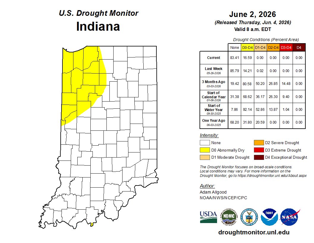
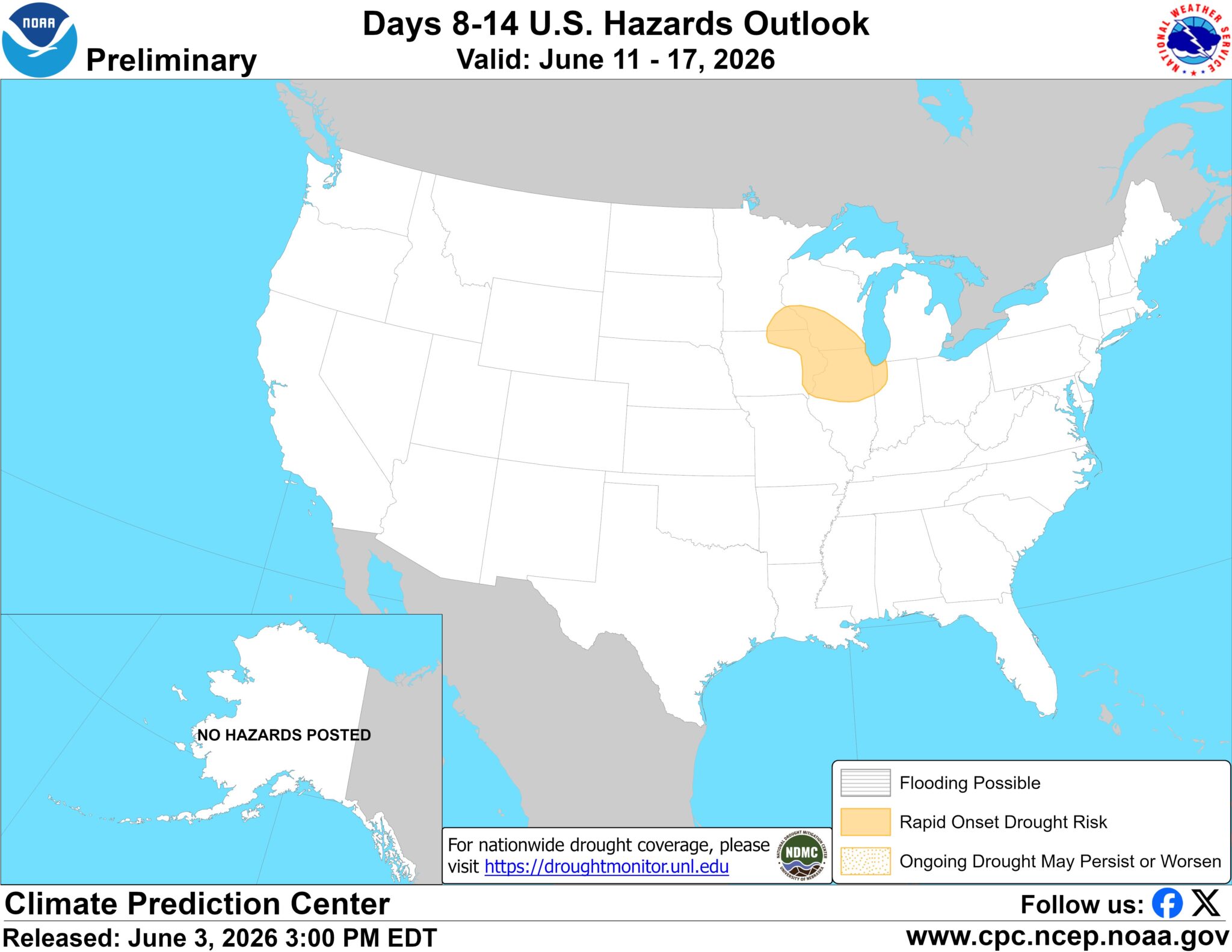
The term “flash drought” has become popularized in recent years to describe a rapidly intensifying drought situation. It could occur within a prolonged drought period where conditions suddenly deteriorate at a much faster rate, or it could start without any preliminary dry condition. In northwestern Indiana, precipitation has been below normal over the past month. This may have been relatively good for agricultural purposes, but at a certain point, the rain needs to start falling again. Unfortunately, forecasts and longer termed (1-3 weeks) climate outlooks are not favoring a whole lot of precipitation in that corner of our state for a while. Therefore, the National Weather Service has issued an early alert for potential rapid intensification of drought within the next few weeks (Figure 1). Michigan and Ohio are also keeping an eye on these local conditions and forecasts because a “flash drought” may develop all along our norther border. This does not suggest one should panic, yet. However, this should raise all our antennas to the possibilities of a flash drought occurring and what sort of proactive measures might be useful to better manage the potential impacts. The most recent U.S. Drought Monitor for Indiana has the northwestern counties highlighted as being Abnormally Dry (D0) (Figure 1). If sufficient precipitation is not received over the next few days and weeks, it will be likely this area may degrade into Moderate Drought (D1) or worse.
As we look back at May’s weather and climate, Indiana was cooler than normal. This might have felt like a pleasant change after April’s record-breaking warmth. These cooler temperatures also kept evapotranspiration rates low allowing soil moisture to remain relatively high, even in northern Indiana where precipitation was either normal or below normal. In contrast, southern Indiana received significant rainfall, so unless weather patterns shift drastically and suddenly, hopefully abnormally dry or drought conditions will not develop there any time soon.
Looking ahead, the National Weather Service is predicting between a tenth of an inch of precipitation (southeast Indiana) to over an inch (northwest Indiana) between June 4th -11th . Unfortunately, due to the warmer temperatures, evapotranspiration (ET) rates over that same period are predicted to pull between 1.25” and 1.50” of moisture from the surface. While water deficits during the summer growing season is normal, they are not helpful when trying to avoid drought. The 6-to-14-day (June 9-17) climate outlooks are favoring above-normal temperatures across Indiana with near normal precipitation amounts in the first part of that period with a slight chance of above-normal precipitation later. There is a slight risk for extreme heat conditions around June 11th and 12th, so try to plan accordingly to minimize any heat health impacts. The first several extreme heat events of a season can be the most dangerous since our bodies and livestock have yet to acclimate to the warmer conditions.
-

- Figure 1. Hazards potential map highlighting an area of concern in northwestern Indiana for the rapid onset of drought conditions.
-
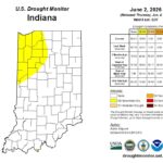
- Figure 2. U.S. Drought Monitor status for Indiana as of conditions through the early morning of June 2, 2026.