Allergy season is in full swing. At least, it is for me. Runny nose, itchy eyes, and consistent drainage that I have to clear in the shower every morning. We love spring, right?? That’s enough complaining for now. Indiana’s April 2024 average temperature was 55.1°F (3°F above normal), which was good enough for 14th warmest on record since 1895. April ended with the 5th most precipitation on record for Aprils dating back to 1895 with 6.63 inches of precipitation. This was 2.24 inches above normal or 151 percent of normal. The wettest Indiana April on record occurred in 2011 when the state observed 9.61 inches of precipitation. This April’s rain helped chew away at precipitation deficits, but led to limited planting windows across the state.
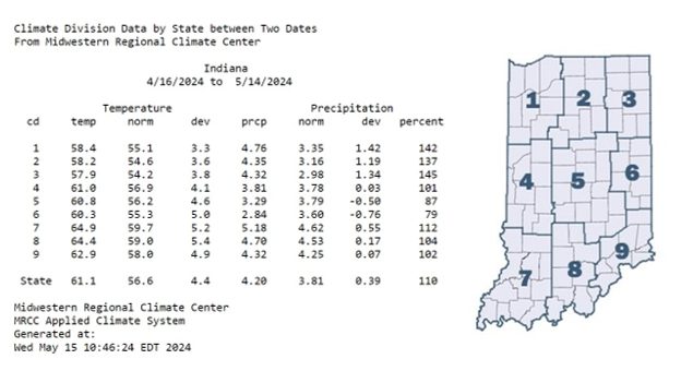
Shifting attention to the last 30 days (April 16-May 14), temperatures have run 2-6°F above the 1991-2020 climatological normal. In fact, Indiana’s statewide average temperature was 61.1°F, 4.4°F above normal for this period (Figure 1). The Evansville Regional Airport observed the highest average temperature in the state (66.4°F), which was 4.3°F above normal for the period. As a result of the above-normal temperatures, growing degree days (GDDs) continued to run ahead of schedule (Figure 2). Statewide, GDDs have accumulated between 240 and 640 units, which was 50 to 150 GDDs above normal.
-
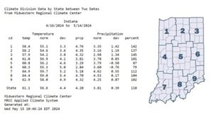
- Figure 1: Temperature and precipitation data for April 16 to May 14, 2024 for Indiana and representative climate divisions (cd). Temperatures are represented as average mean temperature (temp), 1991-2020 normal mean temperature, and mean temperature deviation from normal (dev). Precipitation is represented as the average observed total, 1991-2020 normal precipitation, precipitation deviation from normal, and precipitation represented as the percent of the 1991-2020 climatological normal.
-
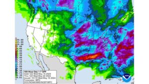
- Figure 3: Weather Prediction Center’s Day 1-7 Quantitative Precipitation Forecast valid from May 15 to May 22, 2024.
Precipitation totals over this period ranged from 1.82 inches in New Castle (Henry County) to 10.18 inches at the Evansville Regional Airport (Vanderburgh County). From April 16 to May 14, the Evansville Regional Airport recorded at least a trace of precipitation on 16 days and averaged roughly 0.35 inches per day. The April 14th precipitation observation yielded 3.42” of rain. Despite the limited planting windows, corn and soybeans planted progress tracked with the five-year average. As of April 12, 36 percent of corn and 34 percent of soybeans have been planted. Today’s equipment and technology allows farmers to plant crops faster than ever!
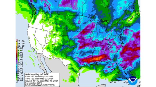
Through May 22, the heaviest rain totals (up to 2.5”) are expected in southern Indiana, whereas northern Indiana could see up to an inch of rain (Figure 3). The Climate Prediction Center expects above-normal temperatures and precipitation from May 20-24, with near-normal temperatures returning toward the end of the month. Elevated chances of above-normal temperatures continue through the end of the month.
-
- Figure 3: Weather Prediction Center’s Day 1-7 Quantitative Precipitation Forecast valid from May 15 to May 22, 2024.