Indiana has seen several rounds of severe weather, and many are likely ready for a break. The good news is there does not seem to be more severe weather in our forecast for at least a week. Heavy rain is anticipated for northern Indiana at the end of this coming weekend, but otherwise, periodic showers may occur across the state every few days. What distinguishes a severe thunderstorm from a non-severe thunderstorm? Certainly not how much rain falls! Severe thunderstorms need to have at least one of the following: a tornado, large hail, or excessively strong winds. In other words, there could still be a lot of rain that leads to local or widespread flooding, but it may not have come from a severe thunderstorm.
With all this rain, most all of Indiana is now drought free! There is the tiniest sliver of Abnormally Dry (D0) in the southernmost tip of Perry County along the Ohio River, but that may be an artifact of the categorical contour lines with the wavy nature of the Ohio River in that area more than a representation of dry conditions (Figure 1). Figure 2 shows the total precipitation amount forecasted through June 25. From June 23 through July 1, temperatures are favored to stay below normal with a return to more normal temperatures by the end of that period. Probabilities for precipitation over the period continue to favor above normal conditions, so expect to see rain event continue for a while.
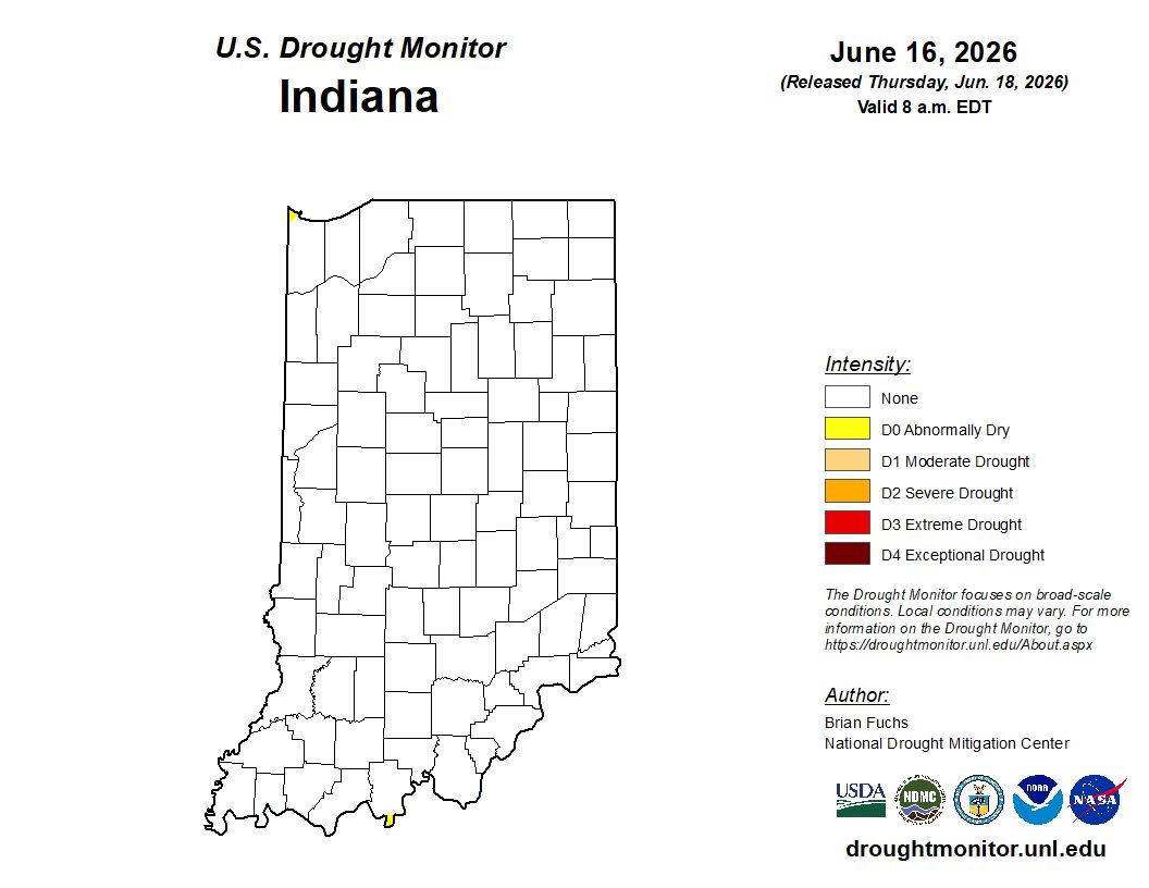
Figure 1. U.S. Drought Monitor map for data through the early morning of Tuesday, June 16th. Most of Indiana is drought free with the exception of the far southern tip of Perry County along the Ohio River.
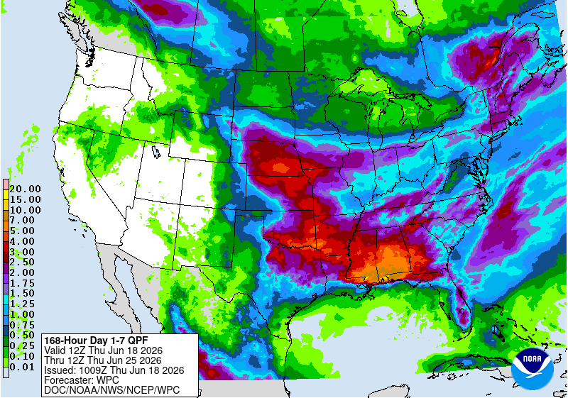
Figure 2. Accumulated forecasted precipitation amounts (in inches) for the morning of June 18 through the morning of June 25.