There’s been a general break since the heavy rain events from several weeks ago. Summer is coming to an end and even some leaves are starting to turn colors. What does all this mean for our weather and climate over the next few weeks and months?
Indiana has remained drought free for the 2nd week in a row according to the U.S. Drought Monitor. There are some areas that are certainly not getting as much rain as others, but in general what has fallen has kept soil moisture levels near normal and vegetation does not appear to be stressed over large regions of the state. Assuming enough rain falls across the state every few days, hopefully any rapidly intensifying drought situation will not develop.
Temperatures are expected to be above normal for a while. There is a slight risk of extreme high temperatures in southern Indiana around the first week of September, but it is too soon to know how intense it might be and how long it will stick around (Figure 1). There’s another heat cell expected over northern Texas and Oklahoma during this period. The uncertainty is how large an area it will impact and how long it will stick around. This may bring above-normal precipitation to Indiana, but hopefully not with the amounts seen a few weeks ago. Much will depend upon storm track patterns around that heat cell and how long the cell stays in one location. Once that system moves on, precipitation in Indiana should be closer to normal for that time of year.
Climate outlooks for September overall are slightly favoring above-normal precipitation for far southern Indiana with no guidance on temperatures across the entire state. The 3-month climate outlook for September through November provide no guidance for either temperature or precipitation. This may mean a lack of consistent above- or below-normal conditions throughout the entire period. Therefore, extremes at both end of the spectrum for temperature and precipitation may be possible.
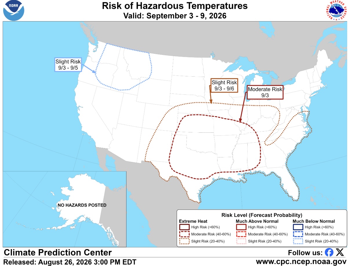
Figure 1. Map of extreme temperature risk for September 3-9, 2026. Product issued by NOAA on August 26, 2026.